DJI FlightHub 2
One-stop Drone Mission Management Cloud Platform
Why choose DJI FlightHub 2?
Comprehensive grasp of on-site dynamics
Break through information barriers and achieve efficient team collaboration
3D simulation route, what you see is what you get
One-stop shop for managing people, equipment and results
Comprehensive understanding of the working environment
2.5D base map
Built-in global elevation information makes flat maps three-dimensional. Practical geographical information makes mission planning more reasonable.
One-click panorama, instant upload
After the drone performs "one-click panorama", the panorama can be instantly uploaded to DJI FlightHub 2 and automatically displayed at the corresponding geographical location, allowing team members to understand the comprehensive situation on site at the first time and facilitate efficient command.
2D cloud mapping
Through visible light or infrared mapping, a high-precision map of approximately 1.5 square kilometers can be obtained in a single flight [2] . No matter day or night, the latest geographical images in the mission area can be obtained efficiently.
Live broadcast
Supports multi-device, low-latency, high-definition live broadcast, real-time understanding of on-site dynamics, and control of the overall situation.
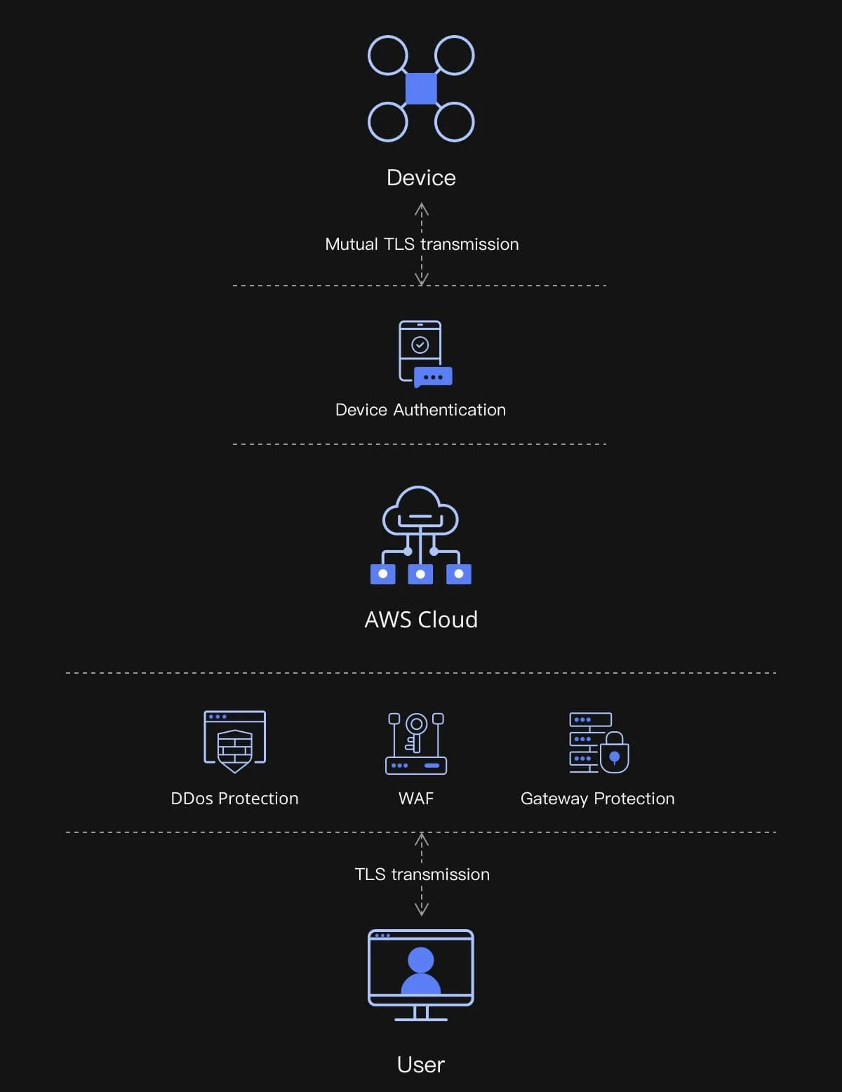
Keep data safe
User data in mainland China is stored on Alibaba Cloud servers (deployed in mainland China), and user data in other regions is stored on Amazon cloud servers (deployed in Europe). It has passed ISO/IEC 27001 security certification.