
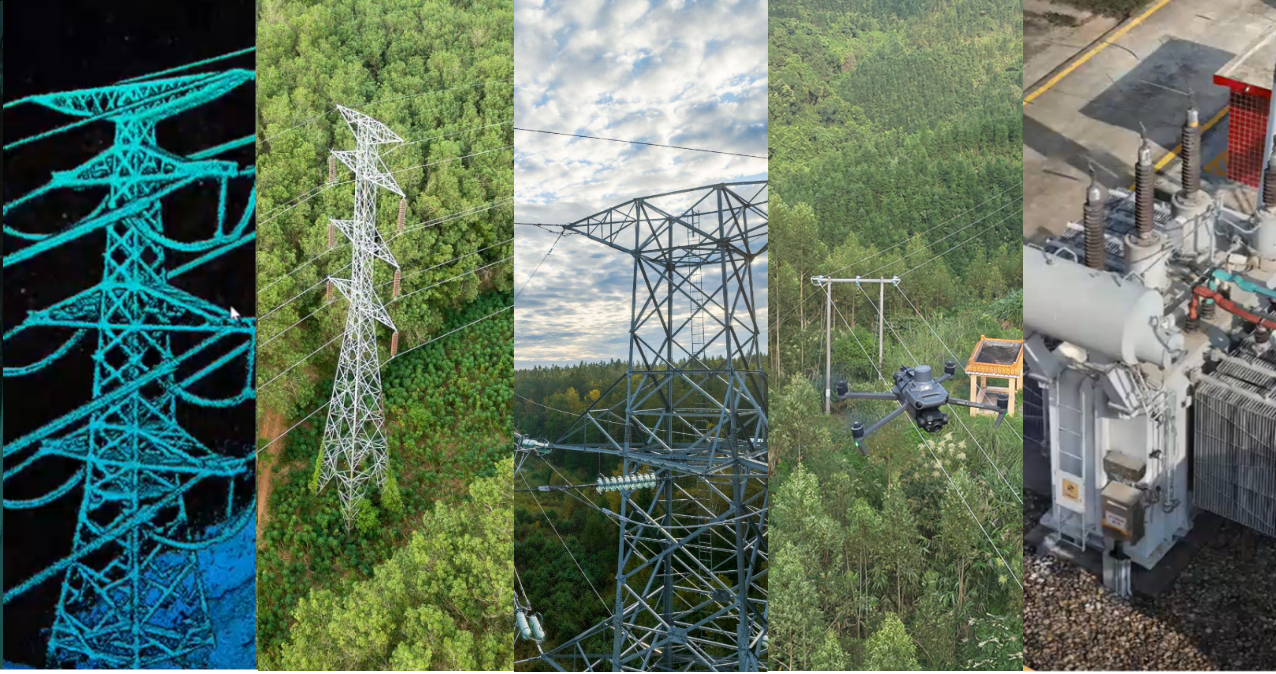
Drone Solutions for Electrical Utilities
Purpose-built aerial workflows for asset digitalization, vegetation management, powerline inspection and substation operation
Introduction:
The electrical grid runs from generation through transmission, substations and distribution to every consumer — and every kilometre of towers, conductors and switchgear must be inspected regularly, much of it across remote terrain. Traditional inspection by crews on foot and manned helicopters is expensive, slow and hazardous. Drone inspection now covers the whole chain — digital twin, vegetation, transmission, distribution and substations — and this solution pairs each demand with the DJI platform and payload that meets it.
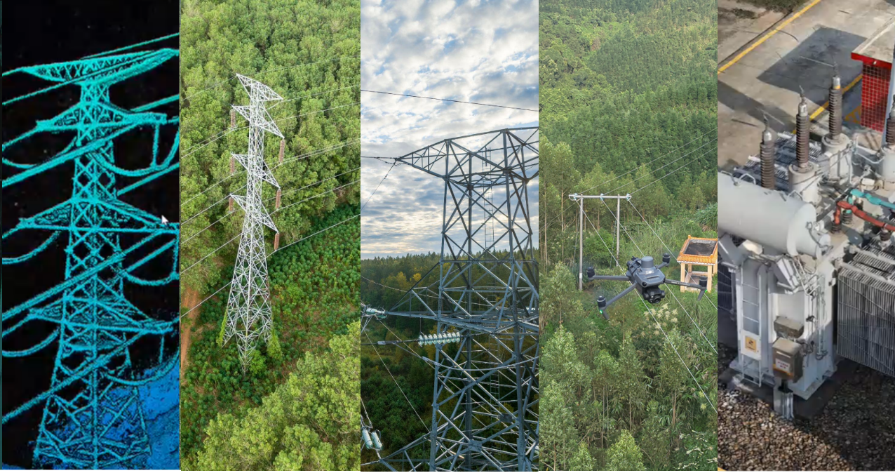
The five inspection demands across the grid: digital twin, vegetation, transmission, distribution and substation.
Operational Challenges:
Traditional inspection runs into four recurring problems, all of which scale with the network.
• Lack of digital twin. Most operators lack an accurate 3D record, so planning, clearance analysis and automated flight rest on incomplete information.
• Costly helicopter inspection. Manned aerial inspection is expensive and carries real safety risk, capping how often lines can be flown.
• Slow, high-risk manual work. Ground and climbing inspection is slow, exposes crews to energised assets and height, and still misses what can't be seen from below.
• Poor reach in remote areas. Getting a qualified crew to a distant fault at inspection standard takes time the network can rarely spare.
Solution at a glance:
The solution combines four aspects — drone platforms (Matrice 400, Matrice 4T/4E), payloads (Zenmuse H30 imaging, Zenmuse L3 LiDAR), software (FlightHub 2, Terra, Modify, DTAT 3) and automation (DJI Dock 3). Each demand maps to a defined capability and configuration.
Three types of solutions:
Small drone: quick and fast response
Bigger drone: long distance
DIAB: repeat mission
| Inspection demand (Pain points) | Capability applied (Solutions) | Enabling platform (Hardware) |
| Lack of digital twin | High-accuracy LiDAR point cloud and a 3D digital twin of the whole corridor | Matrice 400 + Zenmuse L3, Terra, Modify |
| Vegetation encroachment | Point-cloud clearance, change detection and danger-point analysis | Matrice 400 + Zenmuse L3, Terra, Modify |
| Unsafe manual inspection | Standoff visual and thermal inspection with no tower climbing | M400 + Zenmuse H30, Matrice 4T |
| Costly helicopter flights | Docked, remotely launched inspection at a fraction of the cost | DJI Dock 3 + Matrice 4D/TD, FlightHub 2 |
| Poor reach, remote sites | 24/7 autonomous patrol with AI detection and instant alerting | DJI Dock 3 + Matrice 4D/TD, FlightHub 2 |
| Hidden or fine defects | 34x/400x zoom, linked thermal and 48 MP multi-lens capture | Zenmuse H30 series, Matrice 4T |
Applications:
1.Power Asset Digitalization
Core platforms: Matrice 400 + Zenmuse L3 · D-RTK 3 · Terra · Modify
• High-accuracy LiDAR capture. A Matrice 400 with a Zenmuse L3 captures the corridor as a dense point cloud. Powerline Follow tracks the conductors automatically (≈30–40 m, -70°, 8–12 m/s), digitising a line in a single pass with no route planning in advance.
• Detail on critical assets. Multi-return LiDAR at high pulse rates resolves four- and eight-bundle conductors cleanly, reaches taller towers and captures fine tower structure with low noise.
• From point cloud to digital twin. Terra processes the data and Modify classifies and edits it, producing a 3D model of towers, conductors and substations that underpins clearance analysis and automated route planning.
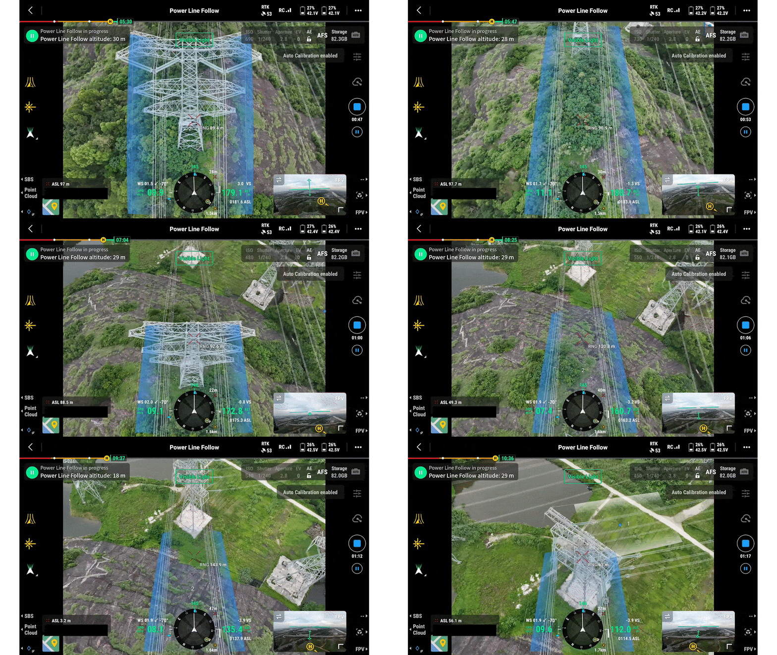
Figure 1: Automatic powerline following with DJI M400 and L3
2.Vegetation Management
Core platforms: Matrice 400 + Zenmuse L3 · D-RTK 3 · Terra · Modify
• Why it matters. Overgrown vegetation contacting conductors causes short circuits, outages and fires; clearance is a regulatory obligation, and managing it proactively is far cheaper than the outage it prevents.
• Point-cloud workflow. The same LiDAR data feeds capture → processing and vegetation classification in Terra and Modify → analysis: canopy height, right-of-way clearance, sag and danger-point identification, with change detection between surveys.
• Safer than ground survey. One aerial survey covers a far larger corridor at higher detail, with no inspector climbing a tower to reach it.
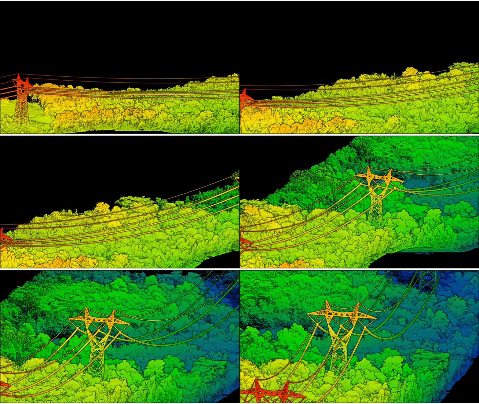
Figure 3: Classified LiDAR model showing conductor-to-vegetation clearance along the corridor.


Figure 2: LiDAR point cloud of transmission towers and conductors captured in a single Powerline Follow pass.
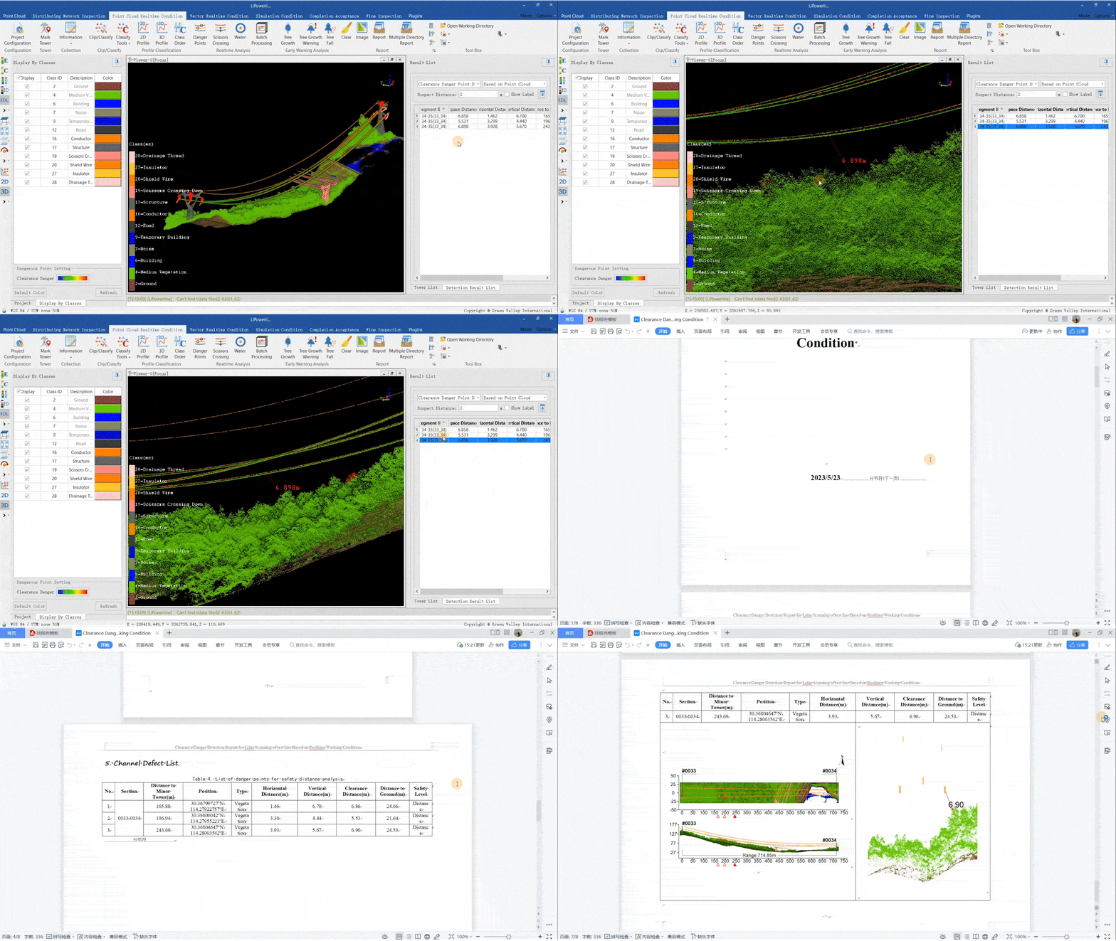
Figure 4: Vegetation analysis and report generation
3. Powerline Inspection
Core platforms: Matrice 400 + Zenmuse H30 series · Matrice 4T · FlightHub 2
• Transmission — M400 + Zenmuse H30. The H30 combines 34x optical / 400x digital zoom, a 3,000 m range finder and a 1280×1024 thermal sensor, inspecting a high-voltage tower in detail from up to 500 m. Linked thermal/visible views, night-scene mode and dehazing keep imagery sharp in poor conditions.
• Distribution — Matrice 4T. The compact Matrice 4T carries 1x/3x/7x cameras (48 MP), a 640×512 thermal sensor and a 1,800 m range finder, with 49-minute flight time and 4G relay. Its 7x camera reaches cotter pins on the far side of a tower; thermal flags components running hot.
• Smart, safe, repeatable capture. Foreground stabilisation holds imagery clear above 10x zoom and obstacle avoidance detects thin conductors. Live Mission Recording with AI Spot Check repeats a route frame-for-frame; FlightHub 2 plans routes directly on the point-cloud model.


Figure 5: Thermal imaging pinpoints hotspots and abnormal-temperature components across the network.
4. Substation Inspection & Security
Core platforms: DJI Dock 3 + Matrice 4D/TD · Zenmuse H30 series · FlightHub 2
• Day and night coverage. Docked aircraft run RGB component inspection by day and thermal at night, with repeatable flight paths that hold the same measurement position every visit — the basis for reliable trend monitoring.
• Always-on unmanned operation. DJI Dock 3 gives 24/7 all-weather standby with no operator on site (IP56 dock / IP55 aircraft, 54-min flight, 10-second take-off, 25 km coverage). Aircraft launch remotely, and edge computing plus a cloud API feed results into existing systems; a 4G dongle, multi-dock relay and no-return-point safeguard extend range and safety.
• A closed inspection loop. Record or import the mission, refine the route in FlightHub 2 on the point-cloud model, execute automatically, analyse thermal findings, and push issues into the work-order system.

Figure 6: RGB component inspection of substation equipment, complemented by night thermal scans.
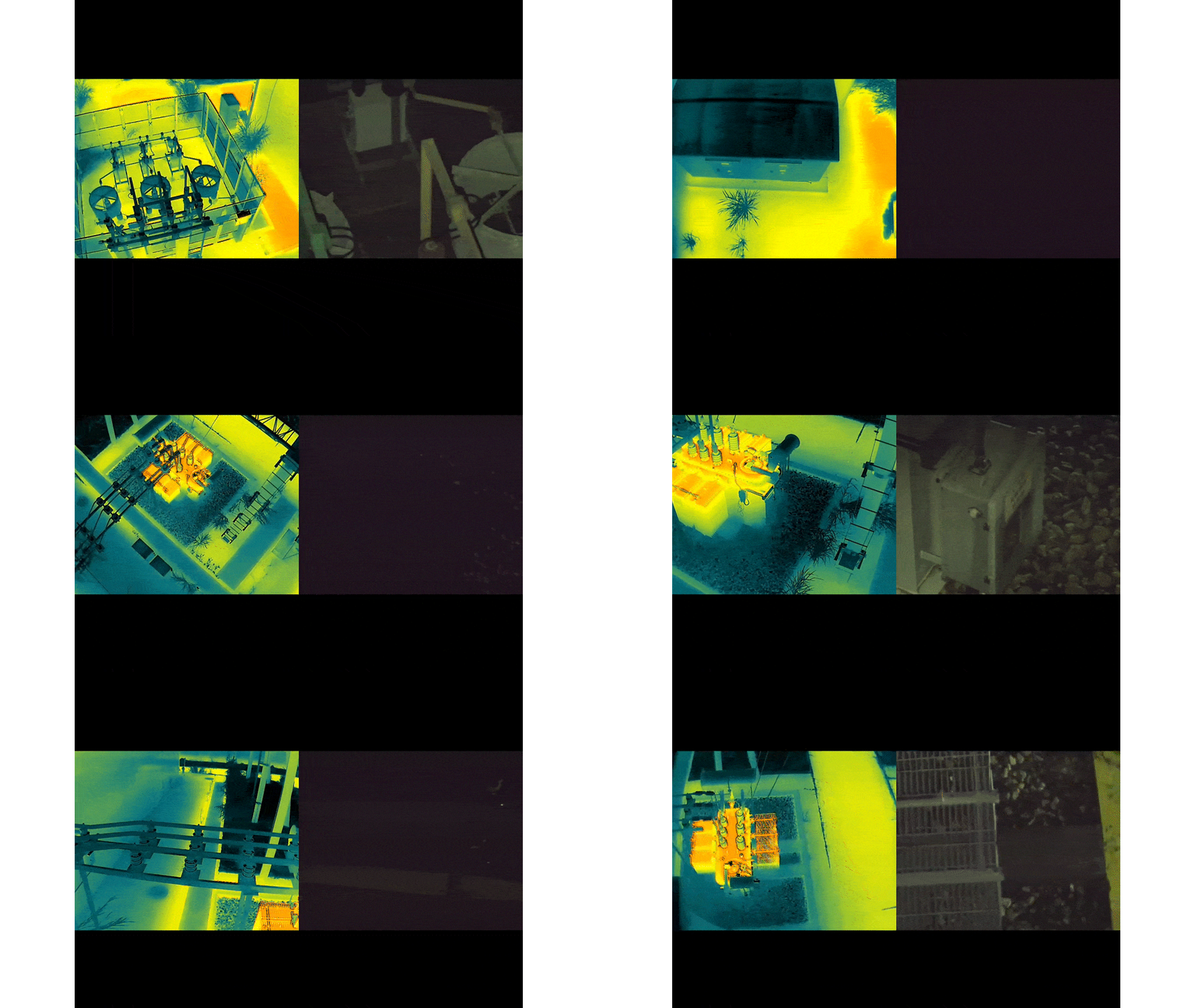
Figure 7: Night thermal inspection for a substation.
Operational Value
• Safety first. Standoff visual and thermal inspection removes tower climbing and manned-helicopter exposure — crews stay on the ground while the aircraft reaches.
• A digital foundation. A high-accuracy point-cloud digital twin turns inspection into a maintained data asset that drives clearance analysis and automated route planning.
• Efficiency and reach. Powerline Follow removes pre-planning, one survey covers what took crews days, and docked aircraft cover fixed sites continuously.
• Cost-effective autonomy. Docked deployment and AI patrol remove flight-hour cost and on-site crewing, making frequent, consistent inspection an operating norm rather than a budget decision.
Not sure which solution fits your needs? Let us help.
Tell us a little about your industry or project type, and our team will reach out to discuss your needs