
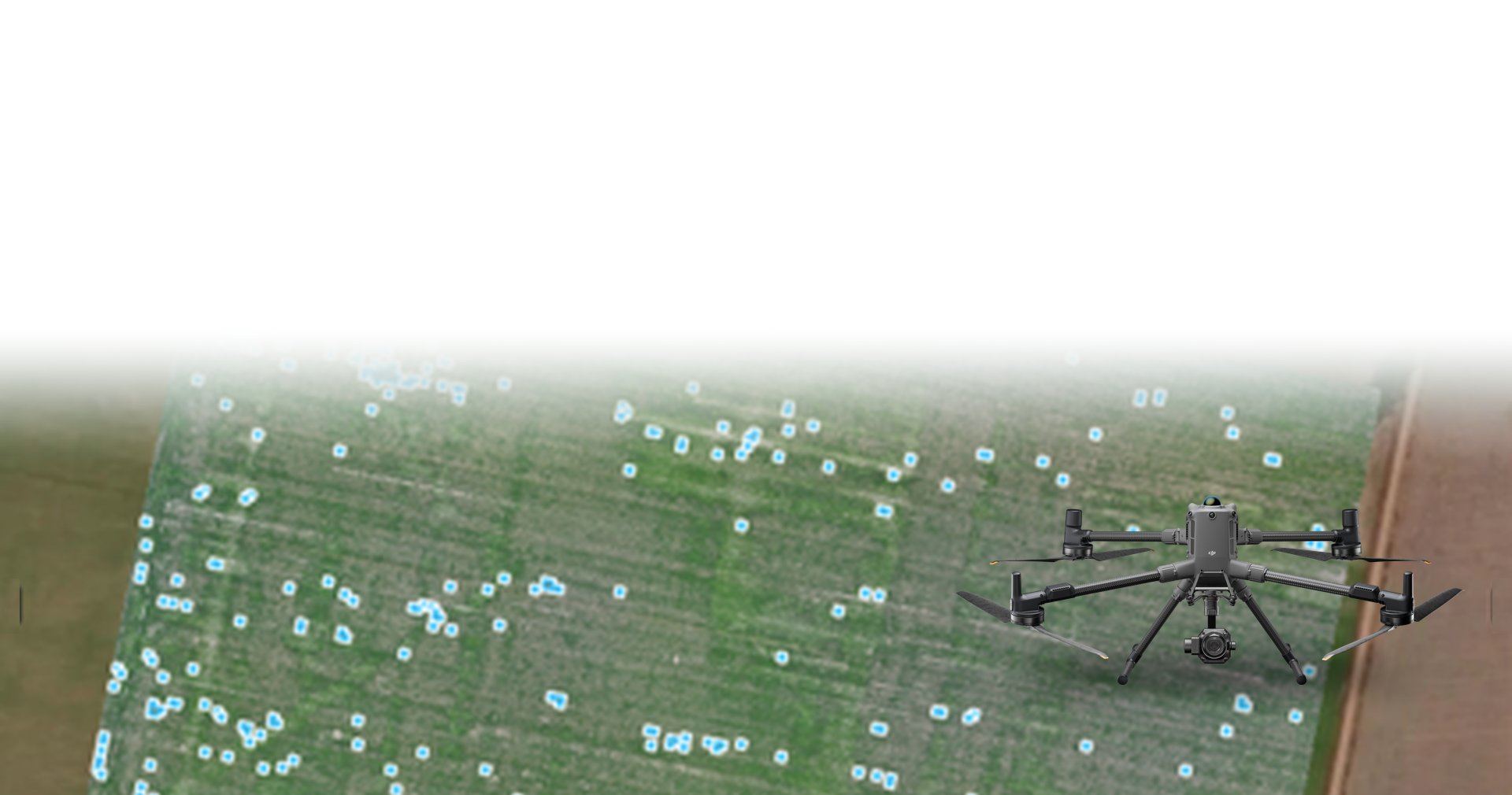
Weed detection
Introduction:
Modern agriculture is shifting from traditional "blanket spraying" to highly efficient "targeted spraying" for precision weed control. This solution introduces a fully integrated, data-driven architecture by merging DJI's advanced enterprise mapping drones with intelligent agricultural sprayers and powerful analytical software. By combining aerial photogrammetry, multispectral imaging, and automated prescription map execution, we deliver a highly efficient workflow that instantly identifies weeds and executes precise treatments.
Background & Painpoints:
Agricultural operations teams currently face critical bottlenecks that drain resources and reduce crop profitability:
Yield Reduction and Resource Competition: Weeds compete directly with crops for essential resources, leading to a significant reduction in yield and quality, causing a severe economic impact.
Environmental and Resistance Concerns: Traditional blanket spraying relies heavily on excessive chemical use, which accelerates herbicide resistance and raises serious environmental and health concerns.
Labor and Cost Inefficiencies: Manual field assessment and widespread chemical application drive up labor requirements and chemical costs, resulting in poor overall cost efficiency.
Solution Introduction:
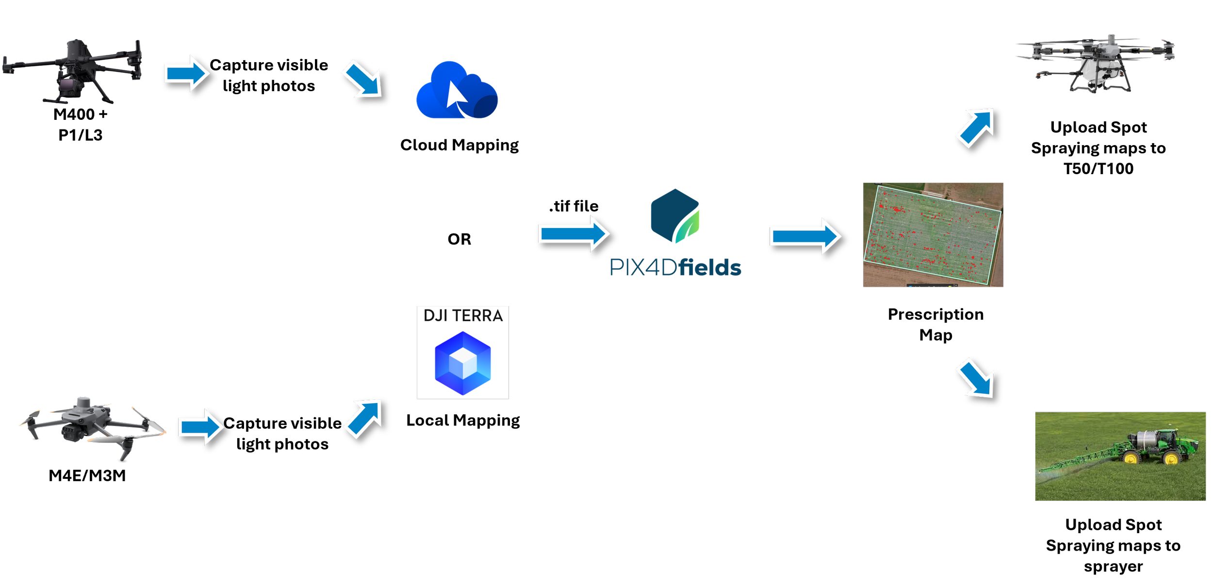
The core system utilizes DJI enterprise mapping drones paired with DJI Agras T-Series sprayers. Through DJI FlightHub 2, DJI Terra, and Pix4Dfields, the hardware integrates seamlessly into a complete three-step workflow: Data Capture, Data Analysis, and Perform.
Key Features:
High-Precision Data Capture: Drones equipped with RTK modules capture highly accurate visible light and multispectral photos (Green, Red, RedEdge, Near-IR) to create detailed vegetation mapping solutions.
Advanced Model Reconstruction: Drone data is processed locally with DJI Terra or on the cloud via DJI FlightHub 2 to rapidly generate precise 2D orthomosaic maps and 3D models.
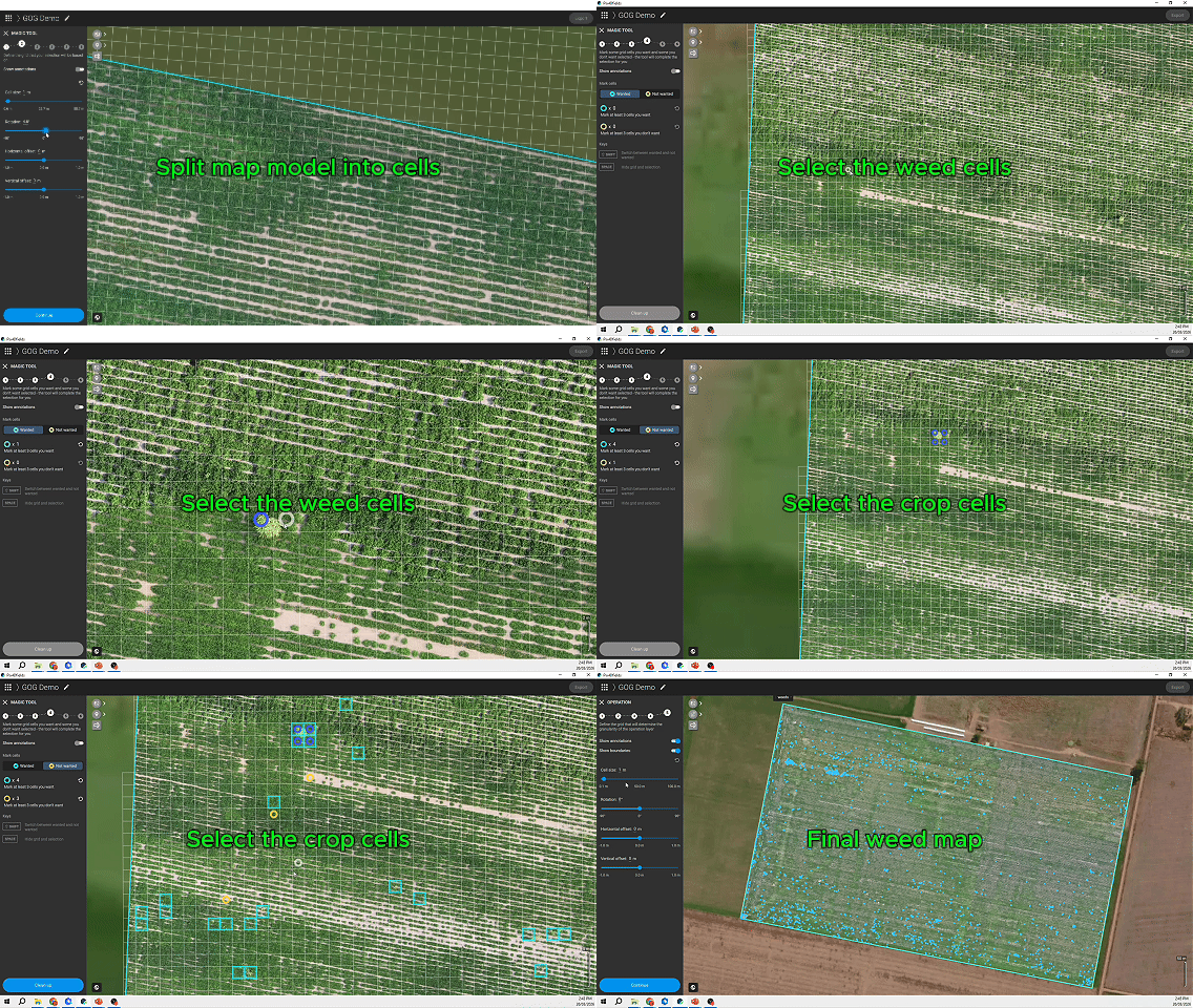
AI-Powered Weed Identification: Using analytical software like the Pix4D Magic Tool, operators can accurately detect weeds in both "Green-on-Brown" (weeds against soil/stubble) and "Green-on-Green" (weeds within a crop canopy) environments.
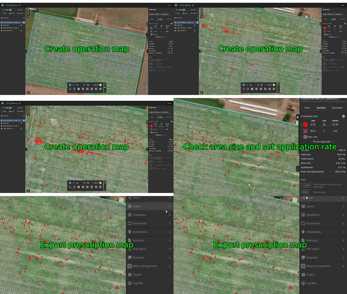
Automated Spot Spraying: The system generates precise prescription maps that are imported directly to DJI Agras T-Series sprayers or traditional sprayers, allowing them to automatically execute variable rate or spot spraying missions.
Workflow:
Weed Control Planning & Mapping:
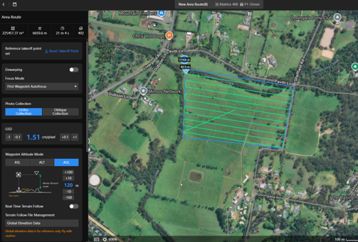
Automated Flight Routing: Operators use DJI FlightHub 2 or DJI Pilot 2 to plan precise area routes. Drones autonomously fly over the farmland to capture data.
Data Analysis & Detection:
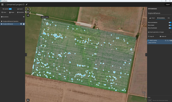
Mark Weeds with Pix4D: Operators import the drone's high-resolution .tif maps into Pix4Dfields. Using the Magic Tool, they automatically mark target weeds and generate a highly accurate spot-spraying prescription map without needing manual field scouting.
Fast & Targeted Treatment:
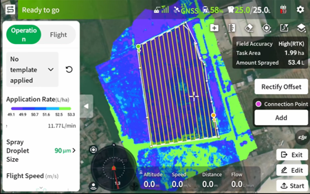
Targeted Spraying with Sprayers: The prescription map is imported to DJI T-series drone or traditional sprayers. The sprayer then autonomously follows the route, applying herbicide strictly to the marked weed zones, drastically outperforming blanket spraying in chemical efficiency.
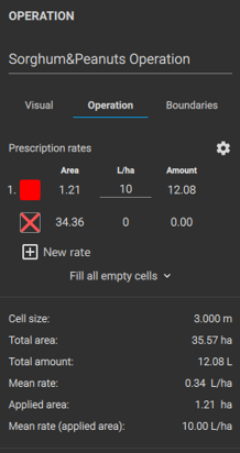
Application Rate and Area Size
Final Weed Map
Post-Assessment:
Result Evaluation: After spraying, mapping drones survey the farmland again to assess the weed control results, track final biomass volume, and ensure optimal plant health.
Results & Summary
By integrating DJI's precision mapping drones with automated sprayers, agricultural teams unlock unmatched value:
Chemical and Cost Efficiency: Transitioning from blanket spraying to targeted spot spraying drastically improves cost efficiency and reduces over 80% chemical waste.
Mitigate Herbicide Resistance & Environmental Impact: By applying chemicals only where absolutely necessary, this solution helps manage herbicide resistance and significantly lowers environmental and health impacts.
Data-Driven Crop Management: Evolve from guesswork to proactive management by utilizing high-resolution 2D/3D maps and multispectral data to optimize plant health, from pre-seeding all the way to harvest.
Not sure which solution fits your needs? Let us help.
Tell us a little about your industry or project type, and our team will reach out to discuss your needs